- Home
- Tonbridge and Malling
- Birling
Civil parish · Tonbridge and Malling · E04005091
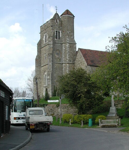
Photo: John Salmon · CC BY-SA 2.0 · Wikimedia Commons
Birling
464 people lived here at the 2021 census, up 6.2% on 2011. It has 13 listed buildings, 1 of them Grade I.
- District
- Tonbridge and Malling
- Status
- Civil parish
- Size rank
- 285 of 364
- Area
- 6.8 km²
- Postcode
- ME19 5
- Grid
- 51.319°N, 0.410°E
01
Census
Population, 2001 to 2021
4302001
4372011
4642021
Source: Office for National Statistics census figures as recorded in Wikidata.
02
Heritage
13 listed buildings
Most common types: cottage, barn, wall, church building, gatehouse, house.
1Grade I
0Grade II*
12Grade II
0Scheduled
Grade I
Church of All Saints, Birlingchurch building · List entry 1070519
Grade II
74, High Streetlisted building · List entry 1070515
Bank Cottae Ferndale Cottagecottage · List entry 1070516
Barn 60 Yards To North Of Birling Lodgebarn · List entry 1070518
Barn To South East Of Birling Placebarn · List entry 1363099
Birling Asheslisted building · List entry 1070556
Birling Lodgegatehouse · List entry 1070517
Birling Placelisted building · List entry 1363098
No 42 And Forge Adjoining To Righthouse · smithy · List entry 1366275
Sandholelisted building · List entry 1363077
Sandhole Farm Cottagescottage · List entry 1081542
Wall To East Birling Placewall · List entry 1070521
Wall To West And South Of Birling Placewall · List entry 1070522
Source: National Heritage List for England entries recorded in Wikidata with this parish or town as location.
Twinned with
No twinning recorded.