- Home
- Tunbridge Wells
- Rusthall
Civil parish · Tunbridge Wells · E04012174
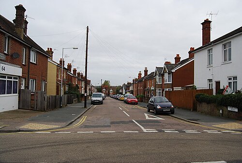
Photo: Nigel Chadwick · CC BY-SA 2.0 · Wikimedia Commons
Rusthall
4,869 people lived here at the 2021 census, down 2.2% on 2011. It has 6 listed buildings.
- District
- Tunbridge Wells
- Status
- Civil parish
- Size rank
- 78 of 364
- Postcode
- TN4
- Grid
- 51.133°N, 0.235°E
01
Census
Population, 2011 to 2021
4,9762011
4,8692021
Source: Office for National Statistics census figures as recorded in Wikidata.
02
Heritage
6 listed buildings
Most common types: cottage, pub, agricultural structure, drinking fountain.
0Grade I
0Grade II*
6Grade II
0Scheduled
Grade II
1, 3 And 5, 7, Lower Green Roadlisted building · List entry 1338835
55-63, Lower Green Roadlisted building · List entry 1338836
Drinking Fountaindrinking fountain · List entry 1338858
Home Farmagricultural structure · List entry 1338837
Rusthall Cottagecottage · List entry 1084447
The Red Lion Public Housepub · List entry 1084448
Source: National Heritage List for England entries recorded in Wikidata with this parish or town as location.
03
Schools
7 schools nearby
Open schools from the DfE register addressed in Rusthall, or whose nearest town or parish centre in Tunbridge Wells is Rusthall.
| School | Phase | Ages | Pupils | Intake |
|---|---|---|---|---|
| Holmewood House School | Other independent school | 2–13 | 439 | Mixed |
| Rose Hill School | Other independent school | 3–13 | 223 | Mixed |
| Bishops Down Primary and Nursery School | Primary | 3–11 | 194 | Mixed |
| Langton Green Primary School | Primary | 4–11 | 422 | Mixed |
| Rusthall St Paul's CofE Primary School | Primary | 4–11 | 108 | Mixed |
| Bennett Memorial Diocesan School | Secondary | 11–18 | 1,913 | Mixed |
| Broomhill Bank School | Foundation special school | 11–19 | 404 | Mixed |
Neighbours
Twinned with
No twinning recorded.