- Home
- Tonbridge and Malling
- Addington
Civil parish · Tonbridge and Malling · E04005089
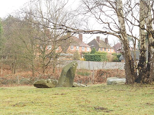
Photo: Simon Burchell · CC BY-SA 4.0 · Wikimedia Commons
Addington
796 people lived here at the 2021 census, up 3.5% on 2011. It has 15 listed buildings, 1 of them Grade I.
- District
- Tonbridge and Malling
- Status
- Civil parish
- Size rank
- 246 of 364
- Area
- 3.3 km²
- Grid
- 51.298°N, 0.352°E
01
Census
Population, 2001 to 2021
7332001
7692011
7962021
Source: Office for National Statistics census figures as recorded in Wikidata.
02
Heritage
15 listed buildings and 2 scheduled monuments
Most common types: farmhouse, chambered long barrow, cottage, church building, stable, chest tomb.
1Grade I
0Grade II*
14Grade II
2Scheduled
Grade I
Church of St Margaretchurch building · List entry 1070567
Grade II
1 and 2, the Laurelslisted building · List entry 1123702
Bumblebee Farmlisted building · List entry 1070564
Chest Tomb 20 Yards To East Of Addington Churchchest tomb · List entry 1123708
East Street Farmhousefarmhouse · List entry 1070565
Hedgehogslisted building · List entry 1070568
Obelisk 20 Yards To East Of Addington Churchobelisk · List entry 1363080
Old Cardicote White Cottagecottage · List entry 1070563
St Vincent'slisted building · List entry 1337427
Stables 120 Yards To The North East Of The Angel Innstable · List entry 1070566
The Angel Innpub · inn · List entry 1363078
Wall 10 Yards To The North East Of Ford Placewall · List entry 1236357
Westfield Farmhousefarmhouse · List entry 1337464
Woodgate Cottagescottage · List entry 1110844
Woodgate Farmhousefarmhouse · List entry 1363081
Scheduled monuments
Addington Long Barrowchambered long barrow · List entry 1015978
Chestnuts long barrowchambered long barrow · List entry 1012917
Source: National Heritage List for England entries recorded in Wikidata with this parish or town as location.
Neighbours
Twinned with
No twinning recorded.