- Home
- Tunbridge Wells
- Horsmonden
Civil parish · Tunbridge Wells · E04005124
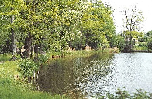
Photo: D Gore · CC BY-SA 2.0 · Wikimedia Commons
Horsmonden
2,400 people lived here at the 2021 census, down 1.4% on 2011. It has 131 listed buildings, 1 of them Grade I.
- District
- Tunbridge Wells
- Status
- Civil parish
- Size rank
- 135 of 364
- Grid
- 51.139°N, 0.429°E
01
Census
Population, 2001 to 2021
2,1692001
2,4352011
2,4002021
Source: Office for National Statistics census figures as recorded in Wikidata.
02
Heritage
131 listed buildings and 1 scheduled monument
Most common types: cottage, farmhouse, barn, hop kiln, stable, chest tomb.
1Grade I
7Grade II*
123Grade II
1Scheduled
Grade I
Church of St Margaretchurch building · List entry 1087022
Grade II*
Broadfordlisted building · List entry 1326674
Capel Manor Houselisted building · List entry 1413746
Grovehurstlisted building · List entry 1338776
Hale Farmhousefarmhouse · List entry 1322819
Rectory Park The Old Rectoryclergy house · List entry 1338186
Spelmonden With Walls Attachedlisted building · List entry 1338789
Spriverslisted building · List entry 1107213
Grade II
All Saints Roman Catholic Churchvacation property · Catholic church building · List entry 1416955
Appletree Cottagecottage · List entry 1325193
Ash Farmhousefarmhouse · List entry 1084503
Ashdown Farmhousefarmhouse · List entry 1338800
August Pitts And Walls Attachedlisted building · List entry 1338774
Bainden Farmhousefarmhouse · List entry 1084505
Barn About 15 Metres East Of Ruck Farmhousebarn · List entry 1084542
Barn About 15 Metres South Of School House Farmhousebarn · List entry 1084504
Barn About 20 Metres North Of Poplarsbarn · List entry 1084556
Barn About 20 Metres North Of Smalls Farmhousebarn · List entry 1084507
Barn About 20 Metres South Of Bennets Housebarn · List entry 1120873
Barn About 30 Metres South Of Yew Tree Farmhousebarn · List entry 1121951
Barn About 30 Metres West Of Elphicksbarn · List entry 1338790
Barn About 5 Metres South East Of Mill Housebarn · List entry 1338769
Barn About 50 Metres South Of Yew Tree Farmhousebarn · List entry 1338793
Barn About 65 Metres South West Of Spriversbarn · List entry 1325190
Barn About 75 Metres North Of Bennets Housebarn · List entry 1338765
Barn About 75 Metres South West Of Spriversbarn · List entry 1338762
Barn And Outhouses About 20 Metres North Of Park Farmhousebarn · List entry 1122015
Barn At Grovehurst Farm, About 50 Metres North Of Grovehurstbarn · List entry 1106227
Barn, Now House With Outhouses About 20 Metres North West Of Baiden Farmbarn · List entry 1338786
Barn, Outbuilding And Former Stables Immediately North West Of Poplarsbarn · List entry 1277670
Bassetts Farmhouse And Oasthouse Attachedfarmhouse · hop kiln · List entry 1322991
Bennets Househouse · List entry 1084537
Birch Cottagecottage · List entry 1084512
Brambles Placelisted building · List entry 1084538
Capel Crosslisted building · List entry 1084526
Capel Cross Cottagecottage · List entry 1084564
Capel Cross Cottagecottage · List entry 1106246
Castlemaine Farm Cottagecottage · List entry 1323752
Cedar Cottagecottage · List entry 1121920
Chest Tomb Of Richard And Alice Tyler, About 1 Metre North Of Church Of St Margaretchest tomb · List entry 1086954
Chest Tomb Of Thomas Twort, About 15 Metres South East Of Church Of St Margaretchest tomb · List entry 1086957
Church Barnlisted building · List entry 1084552
Church Cottagecottage · List entry 1084551
Church Lodgegatehouse · List entry 1084550
Cluncher Cottagecottage · List entry 1338775
Coachhouse About 3 Metres South Of Spring Farmhousecarriage house · List entry 1084560
Coachhouse/Cart Sheds About 50 Metres South West Of Rectory Parkcarriage house · List entry 1338177
Coachhouse/House About 20 Metres West Of Spring Farmhousecarriage house · List entry 1105641
Corner Cottagecottage · List entry 1107849
Cottage Drum And Monkey Housecottage · List entry 1084525
Crossways Shoplisted building · List entry 1121948
Crowhursts' Shop With Wall Attached Heathsidelisted building · List entry 1338791
Dolphin Househouse · List entry 1084563
Elphickslisted building · List entry 1084510
Finchcocks Bridgebridge · List entry 1084703
Game Larder About 10 Metres North Of Spriverslisted building · List entry 1107884
Gate Househouse · List entry 1106288
Granary At Grovehurst Farm, About 50 Metres North West Of Grovehurstgranary · List entry 1338796
Granary/Garage About 30 Metres North Of Haymans Hill Farmhousegranary · List entry 1338798
Haymans Hill Farmhousefarmhouse · List entry 1338797
Heath Cottagecottage · List entry 1121950
Heath Courtlisted building · List entry 1338792
Heathleigh Cottagescottage · List entry 1084541
Kirkins Farmhousefarmhouse · List entry 1084539
Lampkynslisted building · List entry 1338788
Lewes Heathlisted building · List entry 1084534
Lindenlisted building · List entry 1338766
Mableford Cottagecottage · List entry 1338519
Manchester House With The Post Office And Heath Storespost office · List entry 1084513
Milestone Cottagescottage · List entry 1084547
Mill House Millers Cottagecottage · List entry 1084548
Mounting Block About 20 Metres North Of Church Of St Margaretlisted building · List entry 1084555
North Lodgegatehouse · List entry 1325997
Northiam Farm Cottagescottage · List entry 1084506
Oast House At 7055 4031hop kiln · List entry 1084561
Oast House At Grovehurst Farm, About 75 Metres North West Of Grovehursthop kiln · List entry 1084524
Oasthouse About 20 Metres North Of Church Cottagehop kiln · List entry 1338771
Oasthouse About 30 Metres North East Of Hale Farmhousehop kiln · List entry 1084543
Oasthouse About 30 Metres North Of Spelmondenhop kiln · List entry 1338528
Oasthouse About 50 Metres East Of Castlemaine Farm Cottagehop kiln · List entry 1338764
Oasthouse About 50 Metres North Of Park Farmhousehop kiln · List entry 1084508
Oasthouse About 50 Metres West Of Haymans Hillhop kiln · List entry 1084528
Oasthouse And Wall Attached About 15 Metres North East Of Kirkins Farmhousehop kiln · List entry 1121123
Old Bassetts Cottagescottage · List entry 1326669
Old Nevergood Farmhousefarmhouse · List entry 1338768
Outbuildings, Walls And Rear Courtyard North Of Spriversoutbuilding · List entry 1338761
Pair Of Chest Tombs Of Cole Family, About 20 Metres South East Of Church Of St Margaretchest tomb · List entry 1338773
Park Farmhousefarmhouse · List entry 1084509
Park Lodgegatehouse · List entry 1338770
Penhall Cottage Tudor Cottagecottage · List entry 1107202
Poplars Poplars Farmhouse And Wall Attachedfarmhouse · List entry 1104923
Poplars Including Garden Railings To The Northlisted building · List entry 1277637
Pullens Farmhousefarmhouse · List entry 1084529
Railed Chest Tomb Of Hodgkin Family And Railed Enclosure Attached, About 25 Metres South East Of Church Of St Margaretchest tomb · List entry 1086938
Railed Chest Tomb Of Twort Family, About 10 Metres South Of Church Of St Margaretchest tomb · List entry 1084553
Railed Tomb Of Austen Family, About 4 Metres South West Of Church Of St Margaretlisted building · List entry 1086986
Railed Tomb Of Tompsett Family, About 3 Metres South West Of Church Of St Margarettomb · List entry 1338772
Rams Hilllisted building · List entry 1338763
Remingtonslisted building · List entry 1084531
Ruck Farmhousefarmhouse · List entry 1121538
Sandhole And Wall Attachedlisted building · List entry 1338799
School House Farmhousefarmhouse · List entry 1338785
Share Farmhousefarmhouse · List entry 1084549
Small Barn About 20 Metres East Of Kirkins Farmhousebarn · List entry 1084540
Smalls Farmhousefarmhouse · List entry 1338787
South Lodgegatehouse · List entry 1084557
Spring Farmhouse And Railed Forecourtfarmhouse · List entry 1326257
Sprivers Cottagescottage · List entry 1084530
Stable Block And Wall Attached With Hand Pump About 25 Metres South East Of Kirkins Farmhousestable · List entry 1323016
Stable Block And Walled Courtyard To Rear About 50 Metres North Of Spriversstable · List entry 1084533
Stable Block And Walled Gardens About 50 Metres West Of Rectory Parkstable · List entry 1084544
Stable Block To East Of Broadfordstable · List entry 1084558
Stable Or Animal House About 30 Metres West Of Elphicksstable · List entry 1338517
Stable, Now Farm Shop About 30 Metres North East Of Castlemaine Farm Cottagecottage · List entry 1120861
Styles Farmhousefarmhouse · List entry 1084536
Styles Yard Cottage And Oasthousehop kiln · List entry 1084535
Swigs Hole Farmhousefarmhouse · List entry 1104909
Tainter Meadlisted building · List entry 1104866
Tanyard Househouse · List entry 1084562
The Gun And Spitroast Public House And Rear Courtyardpub · List entry 1121941
The Limes Cottagecottage · List entry 1084511
Tompsett's Cottagecottage · List entry 1084532
Wall And Railings Approximately 7 Metres North Of Tanyard Housewall · List entry 1105650
Walled Garden To East Of Haymans Hill Farmhousewalled garden · List entry 1084527
Walls And Railings Surrounding Remingtonswall · List entry 1107207
Walls And Stable Range Attached To South And East Of Elphickswall · List entry 1121963
Weaverslisted building · List entry 1084559
Westernhangerlisted building · List entry 1119621
Wooden Inscription Board To Pierce Family, About 20 Metres North East Of Church Of St Margaretlisted building · List entry 1084554
Yew Tree Cottagecottage · List entry 1084515
Yew Tree Farmhousefarmhouse · List entry 1084514
Scheduled monuments
Medieval moated site at Share Farmmoated site · List entry 1017546
Source: National Heritage List for England entries recorded in Wikidata with this parish or town as location.
03
Schools
1 school nearby
Open schools from the DfE register addressed in Horsmonden, or whose nearest town or parish centre in Tunbridge Wells is Horsmonden.
| School | Phase | Ages | Pupils | Intake |
|---|---|---|---|---|
| Leigh Academy Horsmonden | Primary | 5–11 | 195 | Mixed |
Neighbours
Twinned with
No twinning recorded.