Civil parish · Ashford · E04004844
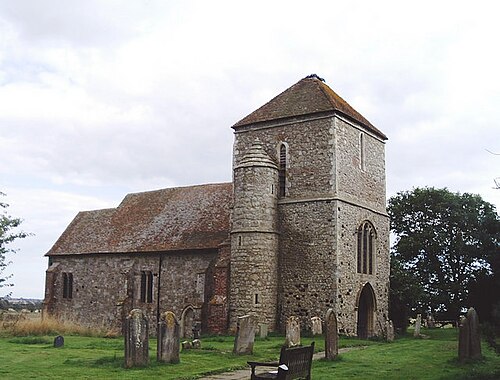
Photo: David Kemp · CC BY-SA 2.0 · Wikimedia Commons
Kenardington
283 people lived here at the 2021 census, up 14.6% on 2011. It has 11 listed buildings.
- District
- Ashford
- Status
- Civil parish
- Size rank
- 316 of 364
- Area
- 7.5 km²
- Postcode
- TN26
- Grid
- 51.062°N, 0.815°E
01
Census
Population, 2001 to 2021
2102001
2472011
2832021
Source: Office for National Statistics census figures as recorded in Wikidata.
02
Heritage
11 listed buildings
Most common types: farmhouse, church building, hop kiln, barn.
0Grade I
2Grade II*
9Grade II
0Scheduled
Grade II*
Church of St Marychurch building · List entry 1116484
Manor Farmhousefarmhouse · List entry 1116469
Grade II
Barn At Higham Farm To South East Of Farmhousebarn · List entry 1070941
Braesidelisted building · List entry 1070939
Cherry Croftlisted building · List entry 1362914
High House Farmhousefarmhouse · List entry 1070937
Higham Farmhousefarmhouse · List entry 1116446
Oasthouse At Manor Farmhop kiln · List entry 1070938
Place Farmhousefarmhouse · List entry 1116497
Sly Cornerlisted building · List entry 1116474
Smith's Farmhousefarmhouse · List entry 1070940
Source: National Heritage List for England entries recorded in Wikidata with this parish or town as location.
Neighbours
Twinned with
No twinning recorded.