Civil parish · Thanet · E04005087
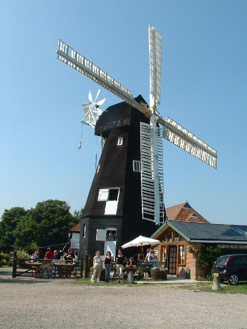
Photo: John Smitten · CC BY-SA 2.0 · Wikimedia Commons
Sarre
221 people lived here at the 2021 census, down 0.5% on 2011. It has 19 listed buildings.
- District
- Thanet
- Status
- Civil parish
- Size rank
- 327 of 364
- Grid
- 51.335°N, 1.236°E
01
Census
Population, 2001 to 2021
1302001
2222011
2212021
Source: Office for National Statistics census figures as recorded in Wikidata.
02
Heritage
19 listed buildings and 1 scheduled monument
Most common types: cottage, thatched barn, pub, smock mill, archaeological site, barn.
0Grade I
0Grade II*
19Grade II
1Scheduled
Grade II
Barn About 10 Metres North Of Bolingbrokethatched barn · List entry 1225053
Barn About 20 Metres North West Of The Elmsthatched barn · List entry 1266545
Barn At G G Baxter's Factorybarn · List entry 1225054
Bolingbrokelisted building · List entry 1225194
Coach House About 20 Metres East Of Bolingbrokecarriage house · List entry 1225201
Court Cottagescottage · List entry 1266550
Kings Head Innpub · inn · List entry 1266480
Lambs Cottagecottage · List entry 1225048
Mill Shoplisted building · List entry 1266227
Olde Cottagecottage · List entry 1225052
Pocockslisted building · List entry 1266549
Sarre Court Hotelhotel · List entry 1225221
Sarre Windmillsmock mill · List entry 1225147
Stable Block About 10 Metres North Of The Elmsstable · List entry 1266544
The Crown Innpub · inn · List entry 1225216
The Elmslisted building · List entry 1225130
Tollgate Cottagecottage · List entry 1225055
White Cottage And Elleswoodcottage · List entry 1225049
Wychwayslisted building · List entry 1266487
Scheduled monuments
Anglo-Saxon cemetery, parish church of St Giles and associated remains immediately east of Sarre Millarchaeological site · List entry 1018879
Source: National Heritage List for England entries recorded in Wikidata with this parish or town as location.
Twinned with
No twinning recorded.