Civil parish · Dover · E04004921
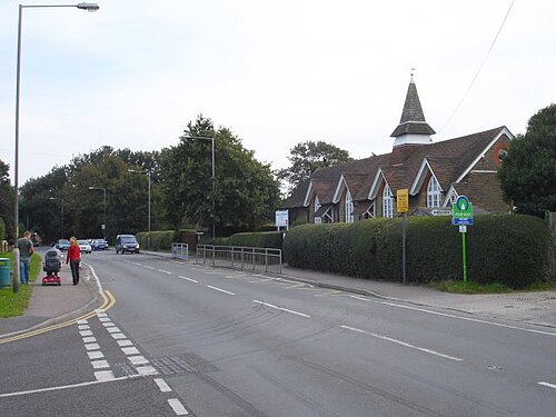
Photo: Penny Mayes · CC BY-SA 2.0 · Wikimedia Commons
Sholden
2,269 people lived here at the 2021 census, up 109.3% on 2011. It has 13 listed buildings.
- District
- Dover
- Status
- Civil parish
- Size rank
- 140 of 364
- Grid
- 51.223°N, 1.371°E
01
Census
Population, 2001 to 2021
9852001
1,0842011
2,2692021
Source: Office for National Statistics census figures as recorded in Wikidata.
02
Heritage
13 listed buildings
Most common types: house, wall, tombstone, church building, farmhouse, milestone.
0Grade I
1Grade II*
12Grade II
0Scheduled
Grade II*
Church of St Nicholaschurch building · List entry 1237584
Grade II
Cottington Court Farmhousefarmhouse · List entry 1237019
Foulmeadlisted building · List entry 1237021
Gates Gate Piers And Wall About 30 Metres North East Of Hull Placewall · gate · List entry 1237024
Hull Placelisted building · List entry 1237023
Milestone At Tr 342 541milestone · List entry 1237022
Sholden Hallhouse · List entry 1264296
Stable Block And The Coach House About 50 Metres North West Of Hull Placestable · List entry 1237025
The Dower Househouse · List entry 1264295
The Old Cottagehouse · List entry 1485541
Tomb Chest And Headstone About 1+5 Metres East Of Church Of St Nicholastombstone · List entry 1237026
Tomb Chest And Vault And Headstone About 2 And 5 Metres North Of Church Of St Nicholastombstone · List entry 1264004
Wall And Outbuilding About 25 Metres South Of Cottington Court Farmhousewall · List entry 1237020
Source: National Heritage List for England entries recorded in Wikidata with this parish or town as location.
03
Schools
1 school nearby
Open schools from the DfE register addressed in Sholden, or whose nearest town or parish centre in Dover is Sholden.
| School | Phase | Ages | Pupils | Intake |
|---|---|---|---|---|
| Sholden Church of England Primary School | Primary | 4–11 | 91 | Mixed |
Twinned with
No twinning recorded.