- Home
- Folkestone and Hythe
- Swingfield
Civil parish · Folkestone and Hythe · E04005039
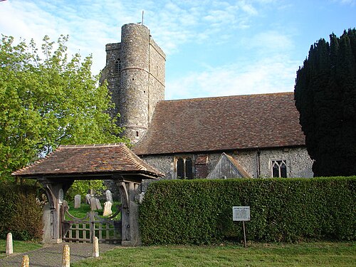
Photo: Adam Hincks · CC BY-SA 2.0 · Wikimedia Commons
Swingfield
1,183 people lived here at the 2021 census, down 3.6% on 2011. It has 8 listed buildings, 1 of them Grade I.
- District
- Folkestone and Hythe
- Status
- Civil parish
- Size rank
- 211 of 364
- Grid
- 51.146°N, 1.190°E
01
Census
Population, 2001 to 2021
1,1712001
1,2272011
1,1832021
Source: Office for National Statistics census figures as recorded in Wikidata.
02
Heritage
8 listed buildings and 2 scheduled monuments
Most common types: agricultural structure, bowl barrow, redundant church, farmhouse, wall, cottage.
1Grade I
1Grade II*
6Grade II
2Scheduled
Grade I
St Peter's Church, Swingfieldredundant church · List entry 1242414
Grade II*
Swingfield Preceptoryfarmhouse · priory · List entry 1242361
Grade II
Lime Tree Cottagecottage · List entry 1242413
Monument to Henry (Collard?) about 5 metres east of chancel of Church of St Petermonument · List entry 1260035
Selsted Farmagricultural structure · List entry 1242368
Smezzle Farmagricultural structure · List entry 1260049
Stockham Farmagricultural structure · List entry 1242409
Wall Approximately 20 Metres North North West Of St John's Commanderywall · List entry 1242405
Scheduled monuments
Bowl barrow 150m north east of Red House Farmbowl barrow · List entry 1011765
Bowl barrow at Minnis Beechesbowl barrow · List entry 1011766
Source: National Heritage List for England entries recorded in Wikidata with this parish or town as location.
03
Schools
1 school nearby
Open schools from the DfE register addressed in Swingfield, or whose nearest town or parish centre in Folkestone and Hythe is Swingfield.
| School | Phase | Ages | Pupils | Intake |
|---|---|---|---|---|
| Selsted Church of England Primary School | Primary | 4–11 | 96 | Mixed |
Twinned with
No twinning recorded.