- Home
- Canterbury
- Waltham
Civil parish · Canterbury · E04004887
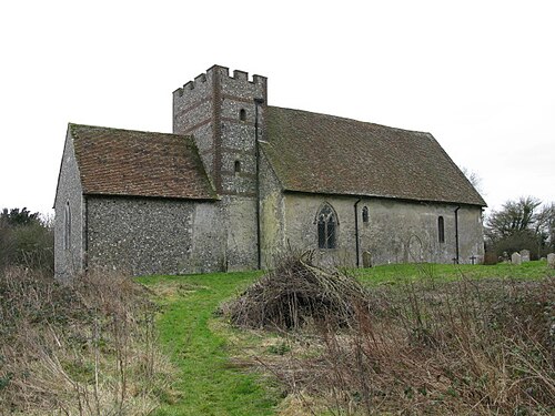
Photo: Nick Smith · CC BY-SA 2.0 · Wikimedia Commons
Waltham
443 people lived here at the 2021 census, up 1.6% on 2011. It has 22 listed buildings, 1 of them Grade I.
- District
- Canterbury
- Status
- Civil parish
- Size rank
- 286 of 364
- Area
- 8.1 km²
- Grid
- 51.198°N, 1.017°E
01
Census
Population, 2001 to 2021
4272001
4362011
4432021
Source: Office for National Statistics census figures as recorded in Wikidata.
02
Heritage
22 listed buildings
Most common types: farmhouse, cottage, house, church building, barn.
1Grade I
1Grade II*
20Grade II
0Scheduled
Grade I
Church of St Bartholomewchurch building · List entry 1367044
Grade II*
Handville Greenlisted building · List entry 1085517
Grade II
Ansdore Farmhousefarmhouse · List entry 1085477
Anvil Green Farmhousefarmhouse · List entry 1336580
Ashenfield Farmhousefarmhouse · List entry 1085481
Barn At Whiteacre Farmbarn · List entry 1085439
Cobwebslisted building · List entry 1336604
Dennes Househouse · List entry 1336603
Kake Cottagecottage · List entry 1085480
Little Londonlisted building · List entry 1085518
Podlingelisted building · List entry 1336579
Sarness Farmhousefarmhouse · List entry 1085478
Sheepcourt Farmhousefarmhouse · List entry 1370055
Temple Fieldlisted building · List entry 1045810
The Chantrylisted building · List entry 1336581
The Cottagecottage · List entry 1054923
Upper Ansdorelisted building · List entry 1336602
Walnut Tree Farmhousefarmhouse · List entry 1078211
Waltham Courtlisted building · List entry 1085515
Well Househouse · List entry 1085479
Yew Tree Cottagecottage · List entry 1336601
Yockletts Farmhousefarmhouse · List entry 1085476
Source: National Heritage List for England entries recorded in Wikidata with this parish or town as location.
Neighbours
Twinned with
No twinning recorded.