Most common types: pub, coal-tax post, church building, almshouse, secondary school, public library.
1Grade I
3Grade II*
47Grade II
0Scheduled
Grade I
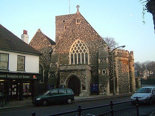
Church of the Holy Trinitychurch building · List entry 1086029
Grade II*
45, High Streetlisted building · List entry 1336369
Priory Farmhouse containing the remains of Dartford Priory Gatehousefarmhouse · List entry 1086030
The Royal Victoria And Bull Inninn · List entry 1086025
Grade II
1 and 3, Overy Streetlisted building · List entry 1116074
11 And 13, Overy Streetlisted building · List entry 1336337
11 High Streetthatched building · List entry 1392304
14 And 16, East Hilllisted building · List entry 1251332
15, High Streetlisted building · List entry 1392298
15, Overy Streetlisted building · List entry 1116084
151 And 151A, Hythe Streetlisted building · List entry 1116247
17, Overy Streetlisted building · List entry 1086033
21 And 23, West Hilllisted building · List entry 1086037
25, West Hilllisted building · List entry 1336340
27 And 29, West Hilllisted building · List entry 1115756
44, High Streetlisted building · List entry 1336370
5-9, Overy Streetlisted building · List entry 1086032
53 And 55, Spital Streetlisted building · List entry 1115767
61, Lowfield Streetlisted building
82, High Streetlisted building · List entry 1336371
Acacia Halllisted building · List entry 1086027
Almshousesalmshouse · List entry 1320067
Christ Churchchurch building · List entry 1336346
Coal Duty Boundary Marker (On The South Side Of Number 1)coal-tax post · List entry 1188345
Coal Duty Boundary Marker At Junction With Crayford Roadcoal-tax post · List entry 1064211
Dartford Grammar Schoolsecondary school · grammar school · List entry 1086055
Dartford Librarypublic library · museum · List entry 1336336
Dartford War Memorialstatue · war memorial · List entry 1393845
Former Dartford Union Workhouse Buildings To Rear And North East Of Range Fronting West Hilllisted building · List entry 1251334
Former West Hill Police Stationpolice station · List entry 1251333
Gartley Cottagescottage · List entry 1336367
Kent House The County Courtpub · List entry 1336339
Martyr's Monument In St Edmund's Chartered Graveyardmonument · List entry 1086023
Methodist ChurchProtestant church building · List entry 1086035
Milestone Opposite Nos 179 And 179Amilestone · List entry 1336347
Mortuary Chapel At Watling Street Burial Groundsepulchral chapel · List entry 1320275
Old Mansion Villa At Bexley Mental Hospitallisted building · List entry 1086054
Post On East Side, Just South Of Railway Embankment And North Of Cranford Housecoal-tax post · List entry 1116091
Post at North West Corner of Road at Junction with Dartford Road outside No 8coal-tax post · List entry 1116059
Range Of Former Dartford Union Workhouse Facing On To West Hilllisted building · List entry 1251335
Remains Of Priory Walls In Victoria Road, Kingsfield Terrace And Priory Lane, Including The Doorway In Kingsfield Terracelisted building · List entry 1086053
St Edmund's Chartered Churchyardlisted building · List entry 1086024
The Bridge Househouse · List entry 1086026
The Coach And Horses Public Housepub · List entry 1116040
The Flying Boatpub · List entry 1387277
The Royal Oak Public Housepub · List entry 1086036
The Two Brewers Public Housepub · List entry 1336335
The Wat Tyler Public Housepub · List entry 1086028
Twistleton's Almshousesalmshouse · List entry 1086038
War Memorial in the Churchyard of St Alban's Churchwar memorial · List entry 1422533
Zion Strict Baptist Chapelchapel · List entry 1336338
Source: National Heritage List for England entries recorded in Wikidata with this parish or town as location. Entries recorded only against the district are placed in the nearest town and may include a few from its outskirts.
03
Schools
21 schools nearby
Open schools from the DfE register addressed in Dartford, or whose nearest town or parish centre in Dartford is Dartford.