Civil parish · Swale · E04012438
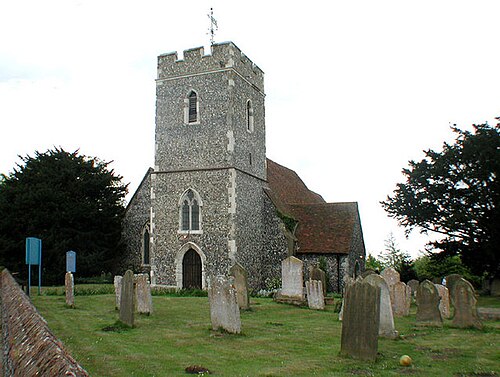
Photo: John Salmon · CC BY-SA 2.0 · Wikimedia Commons
Bobbing
2,913 people lived here at the 2021 census, up 47.9% on 2011. It has 17 listed buildings, 1 of them Grade I.
- District
- Swale
- Status
- Civil parish
- Size rank
- 115 of 364
- Grid
- 51.350°N, 0.700°E
01
Census
Population, 2001 to 2021
1,6942001
1,9692011
2,9132021
Source: Office for National Statistics census figures as recorded in Wikidata.
02
Heritage
17 listed buildings
Most common types: farmhouse, cottage, church building, barn, house.
1Grade I
0Grade II*
16Grade II
0Scheduled
Grade I
Church of St Bartholomew, Bobbingchurch building · List entry 1299598
Grade II
1-2 Layfield Cottagescottage
14 And 16, Keycol Hilllisted building · List entry 1069415
Barn 20 Yards South Of Great Norwoodbarn · List entry 1069417
Bobbing Courtlisted building · List entry 1069418
Bobbing Place And Garden Walllisted building · List entry 1343865
Church Farm Cottagescottage · List entry 1069421
Great Norwoodlisted building · List entry 1343863
Laurelin House And Luxton Houselisted building · List entry 1069419
Little Chequerslisted building · List entry 1343862
Nether Toeslisted building · List entry 1343866
Parsonage Farm Housefarmhouse · List entry 1069416
Pheasant Farmhousefarmhouse · List entry 1061047
Pheasants Farmhousefarmhouse · List entry 1343861
Sole Placelisted building · List entry 1343864
The White Househouse · List entry 1069420
Upper Toeslisted building · List entry 1299595
Source: National Heritage List for England entries recorded in Wikidata with this parish or town as location.
03
Schools
1 school nearby
Open schools from the DfE register addressed in Bobbing, or whose nearest town or parish centre in Swale is Bobbing.
| School | Phase | Ages | Pupils | Intake |
|---|---|---|---|---|
| Bobbing Village School | Primary | 4–11 | 192 | Mixed |
Twinned with
No twinning recorded.