Civil parish · Swale · E04012440
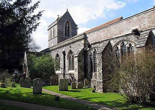
Photo: John Salmon · CC BY-SA 2.0 · Wikimedia Commons
Tunstall
1,611 people lived here at the 2021 census, up 82.2% on 2011. It has 20 listed buildings, 2 of them Grade I.
- District
- Swale
- Status
- Civil parish
- Size rank
- 178 of 364
- Grid
- 51.330°N, 0.720°E
01
Census
Population, 2001 to 2021
8772001
8842011
1,6112021
Source: Office for National Statistics census figures as recorded in Wikidata.
02
Heritage
20 listed buildings
Most common types: cottage, stable, house, barn, monument, church building.
2Grade I
0Grade II*
18Grade II
0Scheduled
Grade I
Church of St John the Baptistchurch building · List entry 1069356
Tunstall Houselisted building · List entry 1069357
Grade II
Barn 30 Yards North Of Grove Endbarn · List entry 1115681
Barn 60 Yards North East Of Grove Endbarn · List entry 1343911
Cedar Househouse · List entry 1343912
Former Oast, Now Garage 10 Yards South Of The Oasthop kiln · thatched building · List entry 1069359
Grove Endlisted building · List entry 1069352
Hales Cottagecottage · List entry 1320356
Hales Househouse · List entry 1069355
Law Family Monument 15 Yards West Of Tunstall Church Towermonument · List entry 1343913
Monument, Homewood Children, 25 Yards South West Of Tunstall Church Towermonument · List entry 1320371
Shepherd's Cottagecottage · List entry 1115629
Stables 20 Yards East Of Hales Housestable · List entry 1320347
Stables 30 Yards North Of Grove Endstable · List entry 1069353
The Denlisted building · List entry 1069354
The Oastthatched cottage · List entry 1320384
The Village Schoollisted building · List entry 1069358
Tunstall House Cottagecottage · List entry 1320331
Wall, Stables And Dovecot South Of Tunstall Housewall · List entry 1320376
Woodstock Home Farmhousefarmhouse · List entry 1115723
Source: National Heritage List for England entries recorded in Wikidata with this parish or town as location.
Twinned with
No twinning recorded.