Civil parish · Swale · E04005069
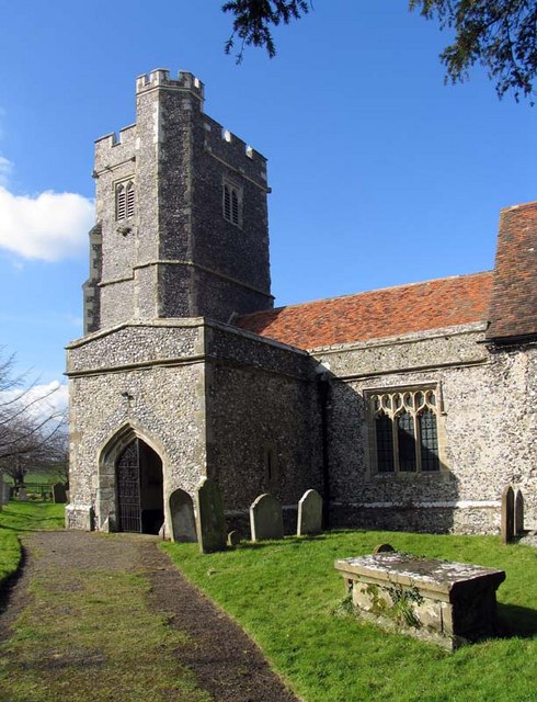
Photo: John Salmon · CC BY-SA 2.0 · Wikimedia Commons
Rodmersham
572 people lived here at the 2021 census, up 3.1% on 2011. It has 20 listed buildings, 1 of them Grade I.
- District
- Swale
- Status
- Civil parish
- Size rank
- 268 of 364
- Grid
- 51.321°N, 0.761°E
01
Census
Population, 2001 to 2021
5632001
5552011
5722021
Source: Office for National Statistics census figures as recorded in Wikidata.
02
Heritage
20 listed buildings
Most common types: cottage, house, barn, farmhouse, church building, gatehouse.
1Grade I
0Grade II*
19Grade II
0Scheduled
Grade I
Church of St Nicholaschurch building · List entry 1120902
Grade II
Baker Cottagescottage · List entry 1069290
Barn 20 Yards East Of Orchard Farmhousebarn · List entry 1069253
Barn At Dungatebarn · List entry 1120916
Barn At Tq 921 618barn · List entry 1120908
Church Cottagecottage · List entry 1069287
Church Househouse · List entry 1323761
Dungate Househouse · List entry 1343919
Highsted Farmhousefarmhouse · List entry 1069289
Hill Farmlisted building · List entry 1069293
Holly Tree Lodgegatehouse · List entry 1069291
Matsonslisted building · List entry 1343920
Old Cottagecottage · List entry 1120885
Orchard Farmhousefarmhouse · List entry 1069294
Orsett Househouse · List entry 1069292
Pardoners Cottagecottage · List entry 1323137
Rodmersham Househouse · List entry 1069288
Stanley Villaslisted building · List entry 1343921
Victoria Househouse · List entry 1323163
Vine Cottagescottage · List entry 1120864
Source: National Heritage List for England entries recorded in Wikidata with this parish or town as location.
Twinned with
No twinning recorded.