Civil parish · Ashford · E04012784
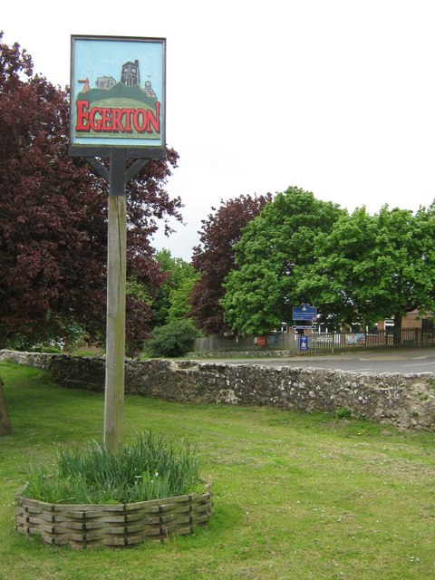
Photo: David Anstiss · CC BY-SA 2.0 · Wikimedia Commons
Egerton
1,054 people lived here at the 2021 census, down 1.8% on 2011. It has 84 listed buildings, 1 of them Grade I.
- District
- Ashford
- Status
- Civil parish
- Size rank
- 222 of 364
- Area
- 12.4 km²
- Postcode
- TN27
- Grid
- 51.194°N, 0.730°E
01
Census
Population, 2001 to 2021
1,1042001
1,0732011
1,0542021
Source: Office for National Statistics census figures as recorded in Wikidata.
02
Heritage
84 listed buildings and 1 scheduled monument
Most common types: farmhouse, cottage, house, barn, hop kiln, agricultural structure.
1Grade I
1Grade II*
82Grade II
1Scheduled
Grade I
Church of St Jameschurch building · List entry 1071496
Grade II*
Link Househouse · List entry 1071518
Grade II
1 and 2, the Streetlisted building · List entry 1071533
Baker's Farmhousefarmhouse · List entry 1071517
Barling's Manormanor house · List entry 1362625
Box Farmhousefarmhouse · List entry 1186195
Brook Househouse · List entry 1362624
Burnt Mill (The Mill House)listed building · List entry 1362995
Burscombe Farmhousefarmhouse · List entry 1362599
Church Househouse · List entry 1319982
Clark Hill Farmhousefarmhouse · List entry 1071549
Coldharbour Farmhousefarmhouse · List entry 1362596
Court Lodgegatehouse · List entry 1071498
Dorne Cottagescottage · List entry 1116549
Egerton House (Ashford)house · List entry 1071528
Field Mill (The Mill Building)mill building · List entry 1070775
Field Mill (The Mill House)mill building · List entry 1185638
Forge Cottagescottage · List entry 1362626
Frid Farmhousefarmhouse · List entry 1071513
Garage To North East Of Field Millgarage · List entry 1070776
Glebe Cottagecottage · List entry 1071495
Good Intent Cottagescottage · List entry 1071529
Granary To South Of Newlands Farmhousegranary · List entry 1116466
Greenhill Househouse · List entry 1071515
Groom Farmhousefarmhouse · List entry 1116487
Hazeldene Farmhousefarmhouse · List entry 1116472
Hill Dalelisted building · List entry 1071520
Hollis Farmhousefarmhouse · List entry 1362621
Holly Tree Cottagecottage · List entry 1362622
Hopkins General Stores And Post Officepost office · List entry 1071492
Idenlisted building · List entry 1071516
Island Farmhousefarmhouse · List entry 1071552
Jonstone East And Westlisted building · List entry 1362619
K6 Telephone KioskK6 telephone box · List entry 1275166
Kingsden Farmhousefarmhouse · List entry 1362597
Lark Hill Farmagricultural structure · List entry 1362617
Little Manor Cottage Spring Cottagecottage · List entry 1116537
Malthouse Farmhousefarmhouse · List entry 1071531
Mill Househouse · List entry 1071532
Mounting Block Opposite Rock Hill Househouse · List entry 1319909
Mundy Bois Househouse · List entry 1116516
Newlands Farmhousefarmhouse · List entry 1362620
Oasthouse To East Of Hollis Farmhousehop kiln · List entry 1319934
Oasthouse To North Of Court Lodgehop kiln · List entry 1071499
Oasthouse To North Of Stone Hill Farmhousehop kiln · List entry 1071530
Old Harrow Farmhousefarmhouse · List entry 1116546
Ovenden Househouse · List entry 1116479
Pembles Cross Farmhousefarmhouse · List entry 1116470
Poplar Farmhousefarmhouse · List entry 1071514
Potter's Forstal Farmhousefarmhouse · List entry 1186206
Ragged House Farmhousefarmhouse · List entry 1362598
Range Of Barns And Cartsheds 50 Metres To West Of Rock Hill Housebarn · List entry 1071521
Range Of Cartsheds 50 Yards To South East Of Court Lodgelisted building · List entry 1071500
Rock Hill Househouse · List entry 1362618
Star And Garter Cottagecottage · List entry 1319935
Stone Croft Cottagescottage · List entry 1071493
Stone Hill Farmhousefarmhouse · List entry 1319954
Stonebridge Green Cottagecottage · List entry 1116425
Stormgardlisted building · List entry 1071551
The Bakerylisted building · List entry 1319972
The Bedewelllisted building · List entry 1071519
The Cottagecottage · List entry 1071494
The George Inninn · List entry 1071525
The Old Vicarageclergy house · List entry 1116511
The Yewslisted building · List entry 1116540
Timber Framed Barn To North East Of Wanden Farmhouselisted building · List entry 1071501
Timber Framed Barn To South East Of Mundy Bois Houselisted building · List entry 1071523
Verralls Oaklisted building · List entry 1116460
Verralls Oak Cottagecottage · List entry 1362623
Wall And Gatepiers To Churchyard Of Church Of St Jameswall · List entry 1071497
Wanden Farmhousefarmhouse · List entry 1116335
Watersheet Farmhousefarmhouse · List entry 1071550
Weatherboarded Barn 30 Yards To South West Of Court Lodgebarn · List entry 1362645
Weatherboarded Barn 50 Metres To North Of Rock Hill Housebarn · List entry 1071522
Weatherboarded Barn To East Of Stone Hill Farmhouselisted building · List entry 1116433
Weatherboarded Barn To North East Of Buscombe Farmhouseagricultural structure · List entry 1362616
Weatherboarded Barn To North East Of Field Mill, In Grounds Of Millstream Cottagecottage · List entry 1299597
Weatherboarded Barn To North Of Court Lodgebarn · List entry 1362644
Weatherboarded Barn To North Of Malthouse Farmhouseagricultural structure · List entry 1319956
Weatherboarded Barn To South East Of Hazeldene Farmhouselisted building · List entry 1071527
Weatherboarded Barn To South Of Hollis Farmhouselisted building · List entry 1071526
Weatherboarded Barn To South West Of Newlands Farmhouselisted building · List entry 1071524
Weeks Farmhousefarmhouse · List entry 1299310
Woodlands Farmhousefarmhouse · List entry 1319931
Scheduled monuments
Bowl barrow 350m south-east of Egerton Churchbowl barrow · List entry 1012266
Source: National Heritage List for England entries recorded in Wikidata with this parish or town as location.
03
Schools
2 schools nearby
Open schools from the DfE register addressed in Egerton, or whose nearest town or parish centre in Ashford is Egerton.
| School | Phase | Ages | Pupils | Intake |
|---|---|---|---|---|
| Egerton Church of England Primary School | Primary | 4–11 | 197 | Mixed |
| Heath Farm School | Other independent special school | 5–18 | 141 | Mixed |
Twinned with
No twinning recorded.