Civil parish · Swale · E04005056
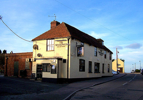
Photo: Richard Dorrell · CC BY-SA 2.0 · Wikimedia Commons
Iwade
4,531 people lived here at the 2021 census, up 46.8% on 2011. It has 5 listed buildings, 1 of them Grade I.
- District
- Swale
- Status
- Civil parish
- Size rank
- 85 of 364
- Postcode
- ME9
- Grid
- 51.376°N, 0.728°E
01
Census
Population, 2001 to 2021
1,1422001
3,0872011
4,5312021
Source: Office for National Statistics census figures as recorded in Wikidata.
02
Heritage
5 listed buildings and 1 scheduled monument
Most common types: church building, anti-aircraft battery, cottage, farmhouse, barn.
1Grade I
0Grade II*
4Grade II
1Scheduled
Grade I
Church of All Saintschurch building · List entry 1069380
Grade II
Coleshall Farmhousefarmhouse · List entry 1116241
Culnellslisted building · List entry 1069379
Ivy Cottagecottage · List entry 1116219
Traditional Agricultural Barnbarn · List entry 1390604
Scheduled monuments
World War II Heavy Anti-aircraft gunsite (TS2), 300m east of Chetney Cottagesanti-aircraft battery · List entry 1020389
Source: National Heritage List for England entries recorded in Wikidata with this parish or town as location.
03
Schools
2 schools nearby
Open schools from the DfE register addressed in Iwade, or whose nearest town or parish centre in Swale is Iwade.
| School | Phase | Ages | Pupils | Intake |
|---|---|---|---|---|
| Iwade School | Primary | 4–11 | 591 | Mixed |
| Craftworks | Special post 16 institution | 16–25 | — | Mixed |
Twinned with
No twinning recorded.