Civil parish · Swale · E04005066
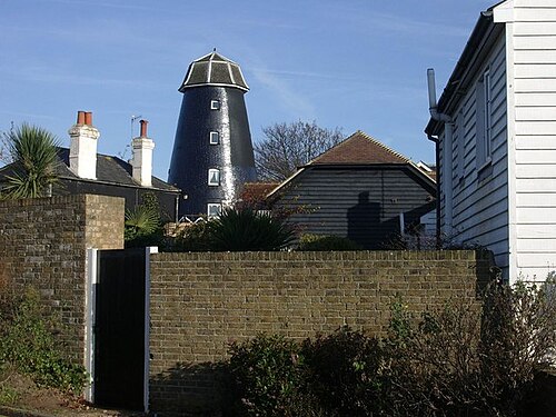
Photo: Pam Fray · CC BY-SA 2.0 · Wikimedia Commons
Oare
505 people lived here at the 2021 census, down 1.6% on 2011. It has 17 listed buildings, 1 of them Grade I.
- District
- Swale
- Status
- Civil parish
- Size rank
- 277 of 364
- Grid
- 51.330°N, 0.878°E
01
Census
Population, 2001 to 2021
5122001
5132011
5052021
Source: Office for National Statistics census figures as recorded in Wikidata.
02
Heritage
17 listed buildings
Most common types: house, tombstone, farmhouse, church building, chest tomb, monument.
1Grade I
1Grade II*
15Grade II
0Scheduled
Grade I
Church of St Peterchurch building · List entry 1069126
Grade II*
Homeside With Railings To Forecourtlisted building · List entry 1344016
Grade II
1, Mount Pleasantlisted building · List entry 1121868
17, Church Roadlisted building · List entry 1069090
9, Church Roadlisted building · List entry 1069091
Barn 15 Metres South East Of Pheasant Farmhousebarn · List entry 1122007
Cheesman's Househouse · List entry 1069098
Chest Tomb To Cock Family About 5 Metres North West Of Church Of St Peter, Oarechest tomb · List entry 1069127
Church Househouse · List entry 1069089
Court Lodge Farmhousefarmhouse · List entry 1344015
Headstone To Edward Cock, About 5 Metres North West Of Church Of St Peter, Oaretombstone · List entry 1069088
Headstone To Thomas And Mary Mockett, D.1750, About 7 Metres North West Of Church Of St Peter, Oaretombstone · List entry 1344014
Monument 3 Metres South Of Church Of St Peter, Oaremonument · List entry 1121978
Mount Househouse · List entry 1069099
Mount Pleasantlisted building · List entry 1344021
Pheasant Farmhousefarmhouse · List entry 1069125
Three Mariners Innpub · inn · List entry 1338204
Source: National Heritage List for England entries recorded in Wikidata with this parish or town as location.
Neighbours
Twinned with
No twinning recorded.