Civil parish · Swale · E04005060
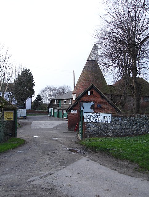
Photo: Penny Mayes · CC BY-SA 2.0 · Wikimedia Commons
Luddenham
97 people lived here at the 2021 census. It has 19 listed buildings, 1 of them Grade I.
- District
- Swale
- Status
- Civil parish
- Size rank
- 344 of 364
- Grid
- 51.333°N, 0.859°E
02
Heritage
19 listed buildings
Most common types: farmhouse, cottage, church building, clergy house, tombstone, outhouse.
1Grade I
0Grade II*
18Grade II
0Scheduled
Grade I
St Mary's Church, Luddenhamchurch building · List entry 1069094
Grade II
Barn 15 Metres South West Of Nash's Farmhousebarn · List entry 1338560
Blackbird Cottagethatched cottage · List entry 1338542
Chest Tomb 20 Metres North West Of Church Of St Marychest tomb · List entry 1344018
Elverton Farmhousefarmhouse · List entry 1069092
Granary 10 Metres South Of Nash's Farmhousegranary · List entry 1344020
Hawkes And Beetles Farmhousefarmhouse · List entry 1069093
Howletts Farmhousefarmhouse · List entry 1123736
Luddenham Courtlisted building · List entry 1069095
Monument 3 Metres North Of Chancel Of Church Of St Marymonument · List entry 1338568
Nash Cottagecottage · List entry 1121862
Nash Farm Cottagescottage · List entry 1121896
Nash's Farmhousefarmhouse · List entry 1069097
Oast Cottagecottage · hop kiln · List entry 1069096
Oasts 20 Metres East Of Luddenham Courthop kiln · List entry 1344019
Outhouse 3 Metres West Of Luddenham Courtouthouse · List entry 1121914
Pair Of Headstones About 20 Metres South West Of Church Of St Marytombstone · List entry 1121907
The Mounted Riflemanlisted building · List entry 1344017
The Old Rectoryclergy house · List entry 1121886
Source: National Heritage List for England entries recorded in Wikidata with this parish or town as location.
Twinned with
No twinning recorded.