Civil parish · Ashford · E04004865
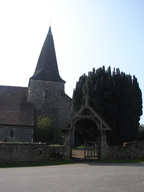
Photo: Adam Hincks · CC BY-SA 2.0 · Wikimedia Commons
Wye with Hinxhill
2,454 people lived here at the 2021 census, up 7.5% on 2011. It has 141 listed buildings, 4 of them Grade I.
- District
- Ashford
- Status
- Civil parish
- Size rank
- 133 of 364
- Postcode
- TN25
- Grid
- 51.181°N, 0.941°E
01
Census
Population, 2001 to 2021
2,4052001
2,2822011
2,4542021
Source: Office for National Statistics census figures as recorded in Wikidata.
02
Heritage
141 listed buildings and 4 scheduled monuments
Most common types: farmhouse, house, barn, cottage, tombstone, church building.
4Grade I
7Grade II*
130Grade II
4Scheduled
Grade I
Church of Saint Gregory and Saint Martin, Wye, Kentchurch building · List entry 1217135
Church of St Marychurch building · List entry 1275459
Cloister Quadrangle, Wye Collegecollege building · List entry 1275610
The Latin School Wye Collegelisted building · List entry 1217080
Grade II*
Old Swan Househouse · List entry 1365318
Spring Grovehouse · school building · List entry 1216831
The Old Flying Horse Inninn · List entry 1216805
The Old Manor Househouse · List entry 1216736
The Wheel House (junior Common Room) Walls And Gates Attachedlisted building · List entry 1275530
Wye Bridgeroad bridge · List entry 1234208
Yew Treeshouse · List entry 1217546
Grade II
1, 3, and 5, Church Streetlisted building · List entry 1216760
1, Upper Bridge Streetlisted building · List entry 1275288
10 and 12, Church Streetlisted building · List entry 1216758
104 And 106, Bridge Streetlisted building · List entry 1234222
105, Bridge Streetlisted building · List entry 1234213
108, Bridge Streetlisted building · List entry 1234197
11, 13 And 15, The Greenlisted building · List entry 1275715
111, 113 And 115, Bridge Streetlisted building · List entry 1276219
114, Bridge Streetlisted building · List entry 1234166
12-22, Scotton Streetlisted building · List entry 1275280
120, Bridge Streetlisted building · List entry 1034417
122, 124 And 126, Bridge Streetlisted building · List entry 1034416
123 And 125, Bridge Streetlisted building · List entry 1234214
127, Bridge Streetlisted building · List entry 1234373
13, Church Streetlisted building · List entry 1216762
137 And 139, Bridge Streetlisted building · List entry 1276220
14 and 16, Church Streetlisted building · List entry 1216768
148/150, Bridge Streetlisted building · List entry 1034415
152, 154, 156 And 158, Bridge Streetlisted building · List entry 1034413
17, 19 And 21, The Greenlisted building · List entry 1216808
17, 19 and 21, Church Streetlisted building · List entry 1275711
18 and 20, Church Streetlisted building · List entry 1216766
2, Cherry Gardens Lanelisted building · List entry 1216721
2, Church Streetlisted building · List entry 1275726
2, Scotton Streetlisted building · List entry 1217542
20, Bridge Streetlisted building · List entry 1234238
22, Church Streetlisted building · List entry 1275753
23-27, The Greenlisted building · List entry 1216807
24 And 26, Scotton Streetlisted building · List entry 1217545
25, 27 And 29, Scotton Streetlisted building · List entry 1275315
26 and 26A, Church Streetlisted building · List entry 1216764
28 And 30, Scotton Streetlisted building · List entry 1275367
32, High Streetlisted building · List entry 1217015
34, High Streetlisted building · List entry 1216924
36, High Streetlisted building · List entry 1216923
38, 40 And 42, High Streetlisted building · List entry 1216922
39, Church Streetlisted building · List entry 1275712
4 and 6, Church Streetlisted building · List entry 1216759
5 And 7, Bridge Streetlisted building · List entry 1234270
6, Cherry Gardens Lanelisted building · List entry 1234218
63-73, Bridge Streetlisted building · List entry 1276217
7, Church Streetlisted building · List entry 1216761
7, Scotton Streetlisted building · List entry 1217544
7, Upper Bridge Streetlisted building · List entry 1217548
77 And 79, Bridge Streetlisted building · List entry 1234298
80, Upper Bridge Streetlisted building · List entry 1217766
87, Bridge Streetlisted building · List entry 1234211
89, 91 And 93, Bridge Streetlisted building · List entry 1234301
9 and 11, Church Streetlisted building · List entry 1275727
95, Bridge Streetlisted building · List entry 1276218
97-103, Bridge Streetlisted building · List entry 1234317
Almshousesalmshouse · List entry 1234201
Amage Farmhousefarmhouse · List entry 1034452
Barn About 10 Metres South West Of Winterbournebarn · List entry 1221236
Barn About 20 Metres North Of Goodcheap Farmhousebarn · List entry 1217084
Barn About 20 Metres South East Of Withersdane Housebarn · List entry 1217568
Barn About 25 Metres North West of Ouseley Farmhousebarn
Barn About 30 Metres East Of Winterbournebarn · List entry 1217570
Barn/Garage About 25 Metres West Of Chelsbournebarn · List entry 1234215
Barn/Stable Block At Little Plumpton (Tr 053429)barn · List entry 1217082
Barns About 20 Metres North Of Sankey Farmhousebarn · List entry 1235052
Boughton Corner Cottagescottage · List entry 1234217
Bramble Farmhousefarmhouse · List entry 1034453
Chelsbournelisted building · List entry 1276143
Chest Tomb And 2 Headstones About 1 Metre South Of Church Of St Marytombstone · chest tomb · List entry 1217366
Chest Tomb To John Oliver, About 2 Metres South Of Church Of Saint Gregory And Saint Martinchest tomb · List entry 1217074
Cockles Hallhouse · List entry 1276222
Cornercroftlisted building · List entry 1216804
Court Lodge And Garden Walllisted building · List entry 1275572
Court Lodge Cottagescottage · List entry 1217374
Cragmore The Wye Hilllisted building · List entry 1275752
Down Farmhousefarmhouse · List entry 1034447
Fishponds Cottagecottage · List entry 1276281
Garden Walls And Walled Garden Surrounding And Attached To Withersdane Housewall · List entry 1217789
Goodcheap Farmhouse And Wall Projectingfarmhouse · List entry 1275440
Great Bromley Farmhousefarmhouse · List entry 1217382
Group Of 7 Headstones About 50 Metres North East Of Church Of Saint Gregory And Saint Martintombstone · List entry 1217078
Handley Crosslisted building · List entry 1275222
Harville Farmhousefarmhouse · List entry 1216832
Headstone To Thomas And John Hudson About 3 Metres North East Of Church Of Saint Gregory And Saint Martintombstone · List entry 1217077
Honeysuckle Cottagecottage · List entry 1034411
House And Shophouse · List entry 1234359
Iron Hand Pump In The Grounds Of Oxenturn Cottagepump · List entry 1217553
James Wyllie Househouse · List entry 1217551
K6 Telephone Kiosk At Junction With Scotton StreetK6 telephone box · List entry 1217539
K6 Telephone Kiosk Opposite Junction With Church StreetK6 telephone box · List entry 1217733
Little Lordslisted building · List entry 1275725
Lloyds Bankbank building · List entry 1216765
Lychgate, Side Gate And Churchyard Walls To Churchyard Of Church Of St Marylychgate · List entry 1217081
Methodist Church And Church Halllisted building · List entry 1034412
Mill House Mill Mill Racemill building · List entry 1234206
Monument With Urn About 40 Metres South East Of Church Of Saint Gregory And Saint Martinmonument · List entry 1217022
Newgatelisted building · List entry 1034382
Nos 1, 3 And 5 And Railed Forecourtlisted building · List entry 1217543
Oast House At Coldharbour Farmhop kiln · List entry 1365295
Obelisk About 20 Metres East Of Church Of Saint Gregory And Saint Martinobelisk · List entry 1275608
Olantighhouse · English country house · List entry 1000295
Ouseley Farmhousefarmhouse · List entry 1217541
Outbuildings About 25 Metres South West Of Amage Farmhouseoutbuilding · List entry 1034451
Perry Courtlisted building · List entry 1275744
Pickersdane Cottagecottage · List entry 1034449
Pickersdane Farmhousefarmhouse · List entry 1034450
Railed Chest Tomb About 20 Metres North West Of Church Of Saint Gregory And Saint Martinchest tomb · List entry 1217076
Rock Cottagescottage · List entry 1217083
Sankey Farmhousefarmhouse · List entry 1234216
Sillibourne Farmhousefarmhouse · List entry 1275443
Springrove Farmhousefarmhouse · List entry 1275686
Stable Block About 20 Metres East Of Harville Farmhousestable · List entry 1216834
Stable/Granary About 10 Metres South Of Withersdane Housegranary · stable · List entry 1217567
Stable/Granary About 20 Metres South Of Harville Farmhousegranary · stable · List entry 1216833
Stables/Barn, Now Wye College Laundrystable · List entry 1217540
Storage Outhouses, About 50 Metres North East Of The Mill Houselisted building · List entry 1234207
Suspension foot bridge over River Stour at TR 0603 4885suspension bridge · footbridge
Swan Househouse · List entry 1275728
Terracotta Coffee Shoplisted building · List entry 1275652
The Former Post Officepost office · List entry 1275713
The King's Headhotel · inn · List entry 1216803
The New Flying Horsepub · List entry 1217550
The Old Vicarageclergy house · List entry 1216806
The Tickled Troutpub · List entry 1234209
The Wife Of Bath Restaurantlisted building · List entry 1217549
Treeslisted building · List entry 1275574
Undercroft At Entrance To Stonegate Egg Packing Stationlisted building · List entry 1365315
Walled Garden And Outhouses At Olantigh Nurserieswalled garden · List entry 1365293
Winterbournelisted building · List entry 1217569
Withersdane Househouse · List entry 1217777
Wye College, Entrance And Hall Quadrangleslisted building · List entry 1217079
Wye Courtlisted building · List entry 1217383
Wye High Schoolschool building · List entry 1275364
Wye Librarypublic library · List entry 1217723
Scheduled monuments
Bowl barrow 300m south-east of The Firs, Broad Downsbowl barrow · List entry 1012334
Hlaew in Juniper Woodscheduled monument · List entry 1011764
Medieval undercroft, Bridge Street, Wyearchaeological site · List entry 1003604
The medieval college of St Gregory and St Martin at Wyearchaeological site · List entry 1010349
Source: National Heritage List for England entries recorded in Wikidata with this parish or town as location.
03
Schools
3 schools nearby
Open schools from the DfE register addressed in Wye with Hinxhill, or whose nearest town or parish centre in Ashford is Wye with Hinxhill.
| School | Phase | Ages | Pupils | Intake |
|---|---|---|---|---|
| Spring Grove School 2003 Ltd | Other independent school | 2–11 | 183 | Mixed |
| Lady Joanna Thornhill Endowed Primary School | Primary | 5–11 | 429 | Mixed |
| Wye School | Secondary | 11–16 | 557 | Mixed |
Twinned with
No twinning recorded.