- Home
- Tonbridge and Malling
- Hildenborough
Civil parish · Tonbridge and Malling · E04005098
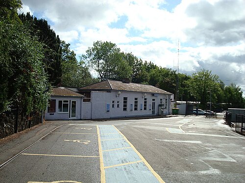
Photo: Stacey Harris · CC BY-SA 2.0 · Wikimedia Commons
Hildenborough
4,977 people lived here at the 2021 census, up 0.5% on 2011. It has 106 listed buildings.
- District
- Tonbridge and Malling
- Status
- Civil parish
- Size rank
- 73 of 364
- Postcode
- TN11
- Grid
- 51.214°N, 0.242°E
01
Census
Population, 2001 to 2021
4,5882001
4,9542011
4,9772021
Source: Office for National Statistics census figures as recorded in Wikidata.
02
Heritage
106 listed buildings
Most common types: cottage, farmhouse, barn, house, stable, carriage house.
0Grade I
3Grade II*
103Grade II
0Scheduled
Grade II*
Nizels Cottagecottage · List entry 1248222
Old Househouse · List entry 1363156
The Old Barn Teahousenightclub · tea house
Grade II
122, London Roadlisted building · List entry 1070431
180, London Roadlisted building · List entry 1363167
182, London Roadlisted building · List entry 1248034
192 And 190, London Roadlisted building · List entry 1070429
34 And 36, Leigh Roadlisted building · List entry 1263841
Angier Chest Tomb About 16 Metres North East Of The Chancel Of The Church Of St Johnchest tomb · List entry 1070428
Asturias Cottage Bassetts Cottagecottage · List entry 1363189
Avalonlisted building · List entry 1070411
Barn About 20 Metres West Of Lime Farmhousebarn · List entry 1363188
Barn About 25 Metres North West Of Great Forge Farmhousebarn · List entry 1248440
Barn About 40 Metres North East Of Lower Street Farmhousebarn · List entry 1070436
Barn Immediately South Of The Plough Innbarn · List entry 1070410
Barn Immediately West Of Latters Farmhousebarn · List entry 1070425
Barn Immediately West Of Old Housebarn · List entry 1248406
Barn, Oast Kiln And Attatched Farmbuilding About 40 Metres North West Of Selbysbarn · farm building · List entry 1070413
Carthorse Stable At Rumshed Farmlisted building · List entry 1070381
Cartshed About 75 Metres North West Of Lower Street Farmhousecarriage house · List entry 1248635
Cartshed About 80 Metres West of Old Barn Farmhousecarriage house
Cartshed Immediately North East Of Little Lucy's Cottagecarriage house · List entry 1070396
Cattle Shed And Pig Sties Immediately South East Of The Threshing Barn At Rumshed Farmcowshed · List entry 1277846
Club Cottagescottage · List entry 1070377
Club Cottagescottage · List entry 1070415
Coach House Immediately North East Of Oakhill Lawncarriage house · List entry 1070430
Cosling Memorial About 26 Metres North Of The West Wall Of The Chancel Of The Church Of St Johnmemorial · List entry 1363166
Drinking Fountain Opposite No 156, London Road, Including Cast Iron Railingsdrinking fountain · List entry 1070434
Dumnelow Memorial About 15 Metres East Of The Tower Of The Church Of St Johnmemorial · List entry 1263825
Durhams Farmhousefarmhouse · List entry 1070424
Farm Cottagecottage · List entry 1363177
Francis Cottagescottage · List entry 1363180
Gate Piers And Pair Of Gates At The Entrance To Mountainsgatepost · List entry 1248299
Gate Piers, Gate And Flanking Walls To The Drive To Nizels Housegatepost · List entry 1070403
Gatepiers, Gates, Garden Walls And Pool North West And West Of Nizels Housegatepost · List entry 1248248
Glen House Princess Christian's Hospitalhospital building · List entry 1248445
Great Forge Farmhousefarmhouse · List entry 1070414
Great Hollanden Househouse · List entry 1277837
Grove Cottagecottage · List entry 1248428
Hay Barn About 20 Metres North Of Limes Farmhousebarn · hay barn · List entry 1070400
Herring Memorial About 12 Metres North East Of The Vestry Of The Church Of St Johnmemorial · List entry 1248026
Hilden Cottagescottage · List entry 1248073
Hildenborough War Memorialwar memorial · List entry 1439848
Hollanden Park Farmhousefarmhouse · List entry 1248507
Iron's Lane Cottagecottage · List entry 1070404
Ivy Cottagecottage · List entry 1248190
Keepers Cottagecottage · List entry 1248262
Limes Farmhousefarmhouse · List entry 1070398
Little Foxbushlisted building · List entry 1277954
Little Lucys Cottagecottage · List entry 1363168
Lodge At The Entrance To Sackville Schoolgatehouse · List entry 1248171
Longholt And The Winglisted building · List entry 1248586
Lower Street Farmhousefarmhouse · List entry 1248178
Lucy's Farmhousefarmhouse · List entry 1363186
Manserslisted building · List entry 1248266
Mansers Farmhousefarmhouse · List entry 1363153
Memorial Cross About 11 Metres South East Of The Tower Of The Church Of St Johnmemorial · List entry 1070427
Milestone At 552 502milestone · List entry 1070426
Milestone At 563 489milestone · List entry 1248013
Milestone At 576 482milestone · List entry 1070432
Mountainslisted building · List entry 1363154
Mountains Lodgegatehouse · List entry 1070406
Muddle Cottagecottage · List entry 1247999
Nizels Farm Cottagecottage · List entry 1070405
Nizels Hoathlisted building · List entry 1248290
Nizels Househouse · List entry 1363190
Oak Hill Househouse · List entry 1277842
Oakhill Lawnlisted building · List entry 1248036
Oasthouse About 50 Metres South West Of Limes Farmhousehop kiln · List entry 1363187
Oasthouse West Of Old Barn Farmhousehop kiln · List entry 1363178
Old Barn Farmhousefarmhouse · List entry 1248525
Old House Farmhousefarmhouse · List entry 1248329
Outbuilding Immediately North East Of Avalonoutbuilding · List entry 1248424
Outbuilding Immediately North East Of Old Farmhouseoutbuilding · List entry 1070408
Parish Church of St Johnchurch building · List entry 1248015
Pembroke Lodgegatehouse · List entry 1363165
Philpotslisted building · List entry 1363155
Pool South East Of Nizels House, Between The Buddha And Sunken Gardenslisted building · List entry 1248252
Quince Cottagecottage · List entry 1248039
Railway Bridge At Stocks Greenrailway bridge · List entry 1070379
Reams Farmhousefarmhouse · List entry 1070397
Remains Of Windmill In The Garden Of The Old Mill Houselisted building · List entry 1070401
Sackville Schoolschool building · English country house · List entry 1248630
Selbys Farmhousefarmhouse · List entry 1248431
Spring Househouse · List entry 1277921
Springwater Cottagecottage · List entry 1363164
St Raphael Medical Centrelisted building · List entry 1070423
Stable About 25 Metres West Of Old Barn Farmhousestable · List entry 1070378
Stable Block About 35 Metres North West Of Great Forge Farmhousestable · List entry 1363157
Stable Block And Carriage House Including Walls To The South East, North Of Mountains Lodgestable · List entry 1070407
Stable Block And Oasthouse About 10 Metres South East Of Lower Street Farmhousestable · hop kiln · List entry 1277834
Stable Block North East Of Avalonstable · List entry 1070412
Stables About 45 Metres West Of Limes Farmhousestable · List entry 1070399
The Bungalowlisted building · List entry 1070435
The Cottagecottage · List entry 1248260
The Flying Dutchman Public Housepub · List entry 1248051
The Lodge, Nizelslisted building · List entry 1070402
The Plough Innpub · inn · List entry 1070409
The Trenchlisted building · List entry 1247988
The Vineslisted building · List entry 1391520
The White Househouse · List entry 1247990
Tips Cross Cottagecottage · List entry 1248361
Trench Farmhousefarmhouse · List entry 1363163
Walls And Steps To The Buddha Garden Immediately East Of Nizel's Housewall · List entry 1277993
Walls, Steps And Statue To The Sunken Garden South East Of Nizels Housewall · List entry 1363152
Woodside Cottagecottage · List entry 1070433
Source: National Heritage List for England entries recorded in Wikidata with this parish or town as location.
03
Schools
4 schools nearby
Open schools from the DfE register addressed in Hildenborough, or whose nearest town or parish centre in Tonbridge and Malling is Hildenborough.
| School | Phase | Ages | Pupils | Intake |
|---|---|---|---|---|
| Sackville School | Other independent school | 11–19 | 197 | Mixed |
| Hildenborough Church of England Primary School | Primary | 4–11 | 200 | Mixed |
| Stocks Green Primary School | Primary | 5–11 | 217 | Mixed |
| Hilden Park | Other independent special school | 6–18 | 37 | Mixed |
Twinned with
No twinning recorded.