Civil parish · Ashford · E04004850
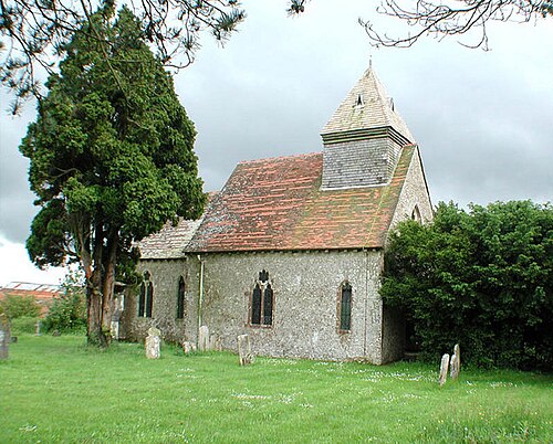
Photo: John Salmon · CC BY-SA 2.0 · Wikimedia Commons
Orlestone
1,649 people lived here at the 2021 census, up 17.2% on 2011. It has 12 listed buildings.
- District
- Ashford
- Status
- Civil parish
- Size rank
- 174 of 364
- Area
- 7.9 km²
- Postcode
- TN26
- Grid
- 51.066°N, 0.863°E
01
Census
Population, 2001 to 2021
1,2812001
1,4072011
1,6492021
Source: Office for National Statistics census figures as recorded in Wikidata.
02
Heritage
12 listed buildings and 1 scheduled monument
Most common types: church building, gatehouse, canal, barn, tombstone, house.
0Grade I
2Grade II*
10Grade II
1Scheduled
Grade II*
Church of St Mary the Virginchurch building · List entry 1184978
Court Lodgegatehouse · List entry 1184992
Grade II
Barn About 50 Metres South East Of Capel Housebarn · List entry 1071198
Bromley Green Farmhousefarmhouse · List entry 1362770
Capel Househouse · List entry 1184965
Fairlawnlisted building · List entry 1071201
Hamstreet And Orlestone Railway Stationlisted building · List entry 1391381
Headstone About 10 Metres South Of Chancel Church Of St Marytombstone · List entry 1071200
Old Eastsidelisted building · List entry 1184950
Stores House Street House The Timbers Woodvillelisted building · List entry 1299876
Sugarloaflisted building · List entry 1071199
The Old Bakerylisted building · List entry 1071197
Scheduled monuments
Royal Military Canal, Warehorne Bridge to Ham Street Bridgecanal · List entry 1005126
Source: National Heritage List for England entries recorded in Wikidata with this parish or town as location.
03
Schools
1 school nearby
Open schools from the DfE register addressed in Orlestone, or whose nearest town or parish centre in Ashford is Orlestone.
| School | Phase | Ages | Pupils | Intake |
|---|---|---|---|---|
| Hamstreet Primary Academy | Primary | 4–11 | 222 | Mixed |
Twinned with
Thérouanne