Civil parish · Ashford · E04004853
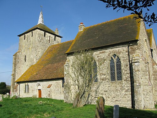
Photo: Nick Smith · CC BY-SA 2.0 · Wikimedia Commons
Ruckinge
767 people lived here at the 2021 census, up 7.9% on 2011. It has 13 listed buildings, 1 of them Grade I.
- District
- Ashford
- Status
- Civil parish
- Size rank
- 247 of 364
- Area
- 13.9 km²
- Postcode
- TN26
- Grid
- 51.066°N, 0.863°E
01
Census
Population, 2001 to 2021
7272001
7112011
7672021
Source: Office for National Statistics census figures as recorded in Wikidata.
02
Heritage
13 listed buildings and 1 scheduled monument
Most common types: farmhouse, cottage, Site of Special Scientific Interest, church building, canal, house.
1Grade I
0Grade II*
12Grade II
1Scheduled
Grade I
Church of St Mary Magdalenechurch building · List entry 1185079
Grade II
Black Beamslisted building · List entry 1071205
Brisley Cottagecottage · List entry 1362771
Chestnutslisted building · List entry 1185047
Court Lodgegatehouse · List entry 1362772
Danlee Farmhousefarmhouse · List entry 1185041
Gorse Green Farmhousefarmhouse · List entry 1071203
Harrison Househouse · List entry 1185036
Hollybush Farmhousefarmhouse · List entry 1185112
Horton Greenlisted building · List entry 1071202
Monument To Ransley Family, About 10 Metres South East Of Church Of St Mary Magdalenelisted building · List entry 1071204
Ransley Cottagecottage · List entry 1185104
Wey Street Farmhousefarmhouse · List entry 1071206
Scheduled monuments
Royal Military Canal, Ham Street Bridge to Bilsington Bridgecanal · List entry 1005127
Source: National Heritage List for England entries recorded in Wikidata with this parish or town as location.
Twinned with
No twinning recorded.